El Chorro: the Village, Station, Reservoirs, Kayaking, Climbing and Via Ferrata
El Chorro is the small village in the municipality of Álora, at the southern end of the Desfiladero de los Gaitanes gorge, where the Caminito del Rey finishes. It has the railway station, El Chorro-Caminito del Rey, with direct trains from Málaga; the stop for the shuttle bus to the start of the walk; a car park for walkers; and, around it, a centre for Spanish and international climbers, a K3 via ferrata and the reservoirs of the Guadalhorce. You cannot start the Caminito here, because entry is only from the north, but most walkers pass through El Chorro at the beginning or the end of their day, and many stay for the rest of what the gorge offers.
This guide covers the village and its station, how El Chorro fits into a Caminito visit, the protected natural area around it, the reservoirs and what you can do on them, and the climbing and via ferrata, with the rules that apply to each.
The short answer
- What it is: a village of Álora at the south exit of the Caminito, with a station, a car park and a shuttle stop.
- Getting there: regional trains from Málaga María Zambrano (fastest 51 minutes) or by car; a hotel in the village puts it at about 1 hour from Málaga.
- The Caminito: you finish here, but you start at the north access by the reservoirs. The M-347 shuttle links the two for €2.50.
- Activities: kayak hire on the Conde de Guadalhorce reservoir from €16, a guided via ferrata from €55, and thousands of climbing routes.
- Rules: no walking on the railway, no climbing above the walkway, and some crags on private land.
Where El Chorro is
El Chorro sits where the Guadalhorce river leaves the Gaitanes gorge, below the Tajo de la Encantada dam. Administratively it belongs to Álora, a white town less than 12 kilometres away; Álora itself is about 40 kilometres from Málaga, in the Guadalhorce valley. The gorge divides the natural area in two, and the road between El Chorro and the northern entrance at Ardales, the MA-444, goes round it rather than through it. That is why the walk needs a shuttle bus.
The Junta de Andalucía describes the gorge’s walls as up to 300 metres high and, for most of their length, no more than ten metres apart, in a canyon more than three kilometres long. From the village you look straight into its southern mouth, with the Caminito’s walkways visible high on the rock.
El Chorro station
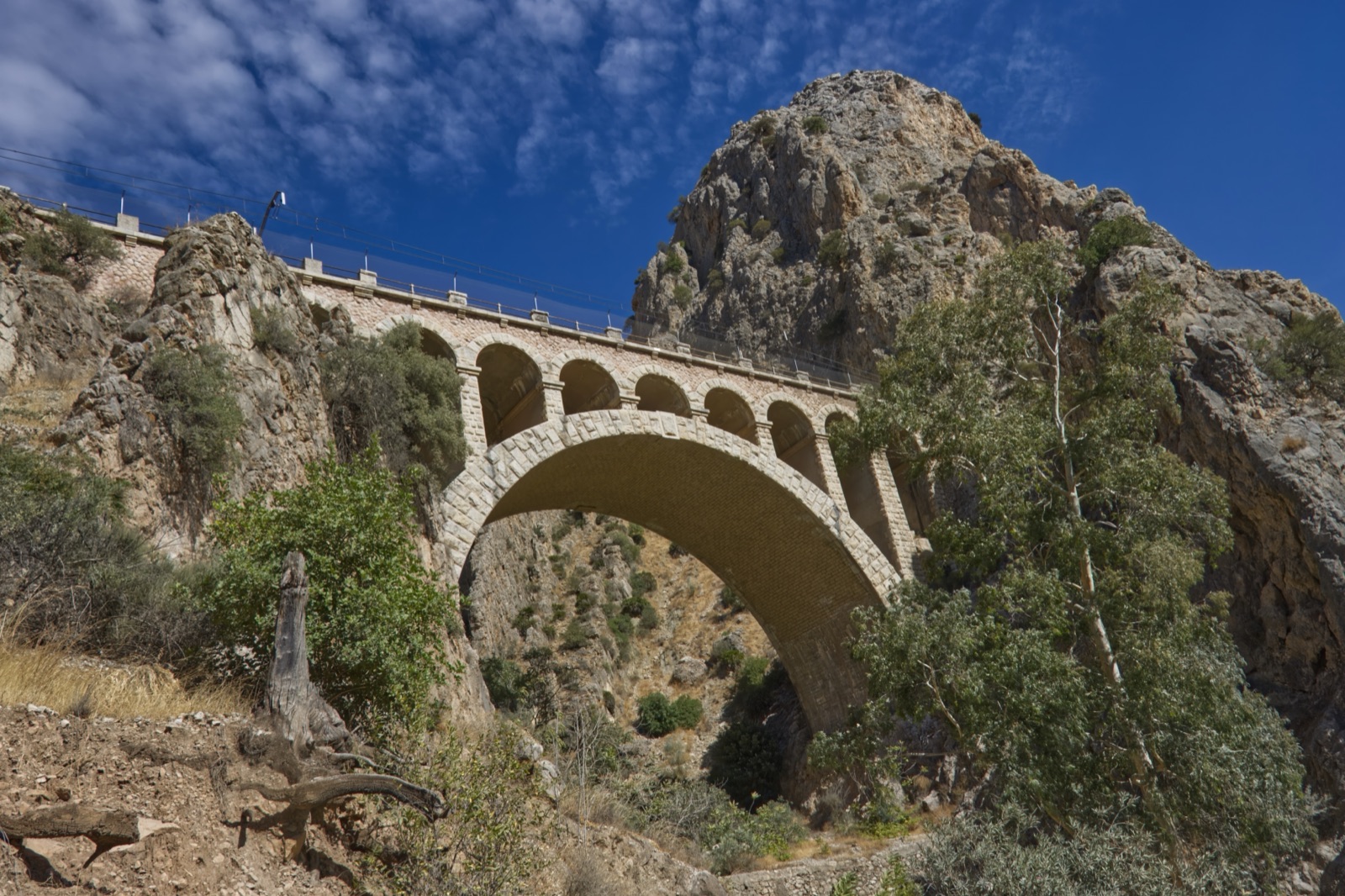
The station is the reason El Chorro exists in its current form. The railway between Málaga and Córdoba through the gorge was completed in 1866, with 17 tunnels more than 5 km long in total, eight viaducts and 18 bridges. At El Chorro it runs on the left bank of the Guadalhorce and through the gorge at almost the same height as the Caminito, which is why walkers see trains emerging from tunnels below them. The station on the other side of the gorge, Gobantes, was flooded by the Guadalhorce reservoir in the 1970s.
The El Chorro station keeps original structures: access tunnels to the tracks, metal water tanks for steam locomotives and the old station building. It was given the name El Chorro-Caminito del Rey on 4 November 2016. Until 2007 all trains between Málaga and the rest of the peninsula used this line; today short and medium-distance trains run on it, and the station is on the MA-5403 road, 29552 El Chorro (Álora).
Trains at a glance. On Saturday 21 November 2026 ADIF’s live board listed regional trains from Málaga María Zambrano arriving at 10:02, 14:21, 16:19 and 18:00, and trains back to Málaga at 09:34, 11:01, 13:06, 18:43 and 21:07, plus Intercity trains to Málaga Centro-Alameda at 10:43 and 16:39. Trains also continue towards Sevilla Santa Justa. Fares on ticket sites start at about €4.40 from Málaga. The full timetable, and how to fit it around a walk, is in our guide to the Caminito del Rey from Málaga.
El Chorro and the Caminito del Rey
Every Caminito visit touches El Chorro, because the route is linear and one way, descending from Ardales in the north to Álora in the south.
- The exit: you leave the walkways at the southern end and walk down to the village. The operator’s timing is 15 minutes from the walkway exit to the south control booth, and another 15 to the station.
- The helmet: at El Chorro you hand back the helmet you were given at the start.
- The shuttle stop: 300 metres from the exit, on the train platform.
- The car park: P2, at the entrance to the village just after the Tajo de la Encantada dam. Park here and you take the shuttle up in the morning and find your car at the finish; the operator recommends being parked at least an hour before your slot.
- The shuttle: line M-347 runs Tuesday to Sunday and on holidays. On the winter timetable, valid from 1 November 2026 to 31 March 2027, the first bus leaves El Chorro at 07:40 and reaches El Kiosko at 08:10, buses run every half hour through the day, and the last leaves at 18:00.
Because entry is only through the north access, El Chorro is a place to arrive at and leave from, never a place to start. Our north access guide explains the other end, and the parking guide compares P2 with the car parks at Ardales.
The Desfiladero de los Gaitanes natural area
The gorge and the hills around it are a protected natural area, a Paraje Natural, declared on 28 July 1989. It covers 2,179.96 hectares in the municipalities of Álora, Antequera and Ardales. It was already a Special Protection Area for Birds in 1987, and since 2006 it has been part of the Andalusia-Morocco Intercontinental Biosphere Reserve.
What to look for:
- Griffon vultures, which keep their breeding colonies on the gorge walls. With binoculars you may also pick out peregrine falcons and golden eagles.
- The river and the dams, a chain of hydroelectric works from the early twentieth century, which is what the original Caminito was built to serve.
- Heritage beyond the gorge: the area’s UNESCO World Heritage candidacy groups seven landmarks within less than 20 km, including the dams, El Chorro station and its bridges, Ardales Cave, the Las Aguilillas necropolis and the Mozarabic rock church of Bobastro.
The usual natural-area manners apply: take your rubbish away, keep noise down, and never light a fire.
The reservoirs: Conde de Guadalhorce, Gaitanejo and Tajo de la Encantada
Upstream of the gorge, three rivers meet: the Guadalhorce and two tributaries, the Turón and the Guadalteba. Together they feed a group of six reservoirs, the Guadalhorce-Guadalteba reservoirs.
| Reservoir | River | Notes |
|---|---|---|
| Conde de Guadalhorce | Turón | The turquoise “El Chorro reservoir”, completed in 1921 |
| Guadalhorce | Guadalhorce | Began holding water in June 1973 |
| Guadalteba | Guadalteba | Began holding water in October 1971 |
| Gaitanejo | Guadalhorce | Small; gathers the water before it enters the gorge |
| Tajo de la Encantada | Guadalhorce | Small; at the southern end, by El Chorro |
| Upper Tajo de la Encantada | Small |
The best known is the Conde de Guadalhorce, first called the Pantano del Chorro. Work on its dam ended on 21 May 1921, King Alfonso XIII inaugurated it that year, and it was renamed in 1953. Alfonso XIII’s crossing of the path at the inauguration is what gave the Caminito del Rey, the “King’s Little Path”, its name. By the water you can still see the Sillón del Rey, a set of stone benches, an armchair and a table where the king signed the completion of the works.
The water of the three big reservoirs is gathered in the small Gaitanejo reservoir before it enters the gorge, and the Caminito’s north control booth stands at the old electrical substation by the Gaitanejo dam. At the southern end, El Chorro’s own car park sits just after the Tajo de la Encantada dam.
The reservoirs are where people swim, picnic and paddle. The Junta notes that the Conde de Guadalhorce’s turquoise water draws visitors to its shores to rest and take part in activities, and there is a campsite on its bank in the municipality of Ardales.
Kayaking on the Conde de Guadalhorce
Kayak hire is the easiest way onto the water, and you do not need any experience. La Garganta, a hotel and activity company in El Chorro, rents kayaks on the Conde de Guadalhorce reservoir:
- Price: from €16.
- Length: a 2-hour rental, self-guided.
- Included: kayak, paddle, life jacket, waterproof barrel, insurance and a navigation permit.
- Meeting point: Camping Parque Ardales, on the Conde de Guadalhorce reservoir, on the Ardales side rather than in El Chorro village.
- Cancellation: free up to 48 hours before.
The reservoir is a calm, enclosed inland lake, which makes it a good add-on for a family after the walk, or a gentle morning before an afternoon slot. Bring water, sun protection and a dry change of clothes.
Climbing in El Chorro
El Chorro, a village in the municipality of Álora, is a centre for Spanish and international climbers, and Málaga’s stable climate means climbing is possible practically all year. Its rock faces can be up to 300 metres high, and there are thousands of routes. Antequera’s tourism office counts more than 300 equipped routes in the Garganta del Chorro itself; the climbers’ lodge Finca La Campana speaks of approximately 2,000 routes across the wider area, and its owners say they have equipped over 150 routes in 20 years there.
What visiting climbers need to know:
- Climbing is regulated. A resolution of 11 July 2018 regulates climbing in the natural area.
- No climbing above the walkway. Climbing directly above the Caminito is prohibited, to stop stones or objects falling on walkers. Montaña Regulada’s El Chorro page lists the routes above the Caminito del Rey as prohibited all year.
- Some sectors are closed. The Petit Desfiladero sector and parts of the eastern walls of the gorges are banned, because the approach means crossing the river or the railway.
- Private land. Some sectors are on private land, where access needs the owner’s permission.
- The railway is off limits. ADIF does not allow walking access to the railway lines, and entering the old trail or the train tunnels carries a €6,000 fine.
- New to climbing? Go with a qualified local guide rather than trying the crags alone.
Check the current restrictions before every trip; they are published sector by sector.
The El Chorro via ferrata
If you want the height without the ropework, the via ferrata above El Chorro station is the local classic. It climbs the walls above the station, with steel cables, rungs, bridges and a zip line.
| Grade | K3, medium difficulty |
| Length | 650 m |
| Height gain | 250 m |
| Highlights | 35-metre zip line, 15-metre Tibetan bridge, 30-metre monkey bridge |
| Time | about 2 hours 30 minutes on the route, 3 hours in total |
| Access | from the station, 15 minutes on foot from parking |
Málaga province’s description calls it a very aerial route.
With a guide. La Garganta’s guided via ferrata costs from €55 and lasts about 4 hours. It starts at the hotel’s reception at the south access, 100 metres from El Chorro-Caminito del Rey station, and no previous via ferrata experience is required, only reasonable fitness. The challenge, the company says, lies more in the route’s length than in its technique.
Without a guide. Only if you have your own via ferrata kit (harness, helmet, energy-absorbing lanyard) and experience on K3 routes. Do not attempt the zip line or the bridges without the right equipment.
Other things to do nearby
- Ardales Cave: a decorated prehistoric cave, discovered in 1821 when an earthquake opened its entrance. Red signs inside have been dated to more than 45,000 years ago, from a time when only Neanderthals lived in southern Iberia. Guided visits run Tuesday to Sunday at 10:00, with an extra visit at 16:00 on Fridays and Saturdays; it is closed on Mondays except holidays. Visits start at the Prehistory Centre in Ardales (Centro de la Prehistoria de Ardales), from where you drive four kilometres behind the guide; inside, the visit lasts an hour and a half over 600 metres of galleries.
- Álora: a white town with a castle built under Moorish rule and one of the largest churches in Málaga province, built between 1600 and 1699. It is also where the malagueña style of flamenco song was born.
- Bobastro: the Mozarabic rock church in the hills above El Chorro, part of the area’s World Heritage candidacy.
- Antequera: a short drive north, with the Antequera Dolmens, on the World Heritage List since 2016.
Planning a day or two in El Chorro
| Plan | Morning | Afternoon |
|---|---|---|
| Caminito by train | 10:02 train from Málaga, shuttle to El Kiosko, walk | Lunch in El Chorro, evening train back |
| Caminito plus water | Kayak on the Conde de Guadalhorce | Afternoon slot on the Caminito |
| Adventure day | Guided via ferrata, about 4 hours | Rest, swim at the reservoirs |
| Climbing trip | Several days at a climbers’ lodge | Crags within walking distance |
If you plan more than one activity, stay a night. El Chorro has a hotel at the station and climbers’ lodges on the hillside, and the reservoirs have a campsite and a hotel; they are compared in where to stay near the Caminito del Rey. For the walk itself, see our route guide. If you would like a guide and want to start and finish in El Chorro, the shuttle combo on our tours page meets by the station, includes the bus up to the north access, and can add a climbing session or an e-bike route in the village.
Practical points
- Mondays: the Caminito and its shuttle are closed, apart from special openings, so El Chorro is quiet. Activity companies may still run.
- Cash: the shuttle takes cash only on board if you have not bought your ticket online.
- Water and shade: there is little shade on the climbing approaches in summer.
- Phone signal: almost none in the gorge itself.
- Respect the railway: the tracks are live and are not a footpath, however tempting the short cut looks.
Quick answers
Can I start the Caminito del Rey at El Chorro? No. Entry is only through the north access; take the M-347 shuttle from El Chorro to El Kiosko first.
Is El Chorro a town? It is a small village of the municipality of Álora, built around the station and the dams.
Can you kayak at El Chorro? Yes. Kayak hire on the Conde de Guadalhorce reservoir starts from €16 for 2 hours.
How hard is the El Chorro via ferrata? It is graded K3, medium, 650 m long with 250 m of height gain; guided versions need no previous experience.
Is El Chorro good for climbing? Yes: it is a centre for Spanish and international climbers, with thousands of routes, but climbing above the Caminito is banned.